Monday, October 19, 2009
Pettifoggery and The Loring Bikeway Epic
Good afternoon readers, and get ready to dance your way into Indian Summer. What does shitty corporate chain pizza have to do with dancing chickens? Frankly, if you have to ask, you’ll never know. But there are stranger things in a city with its Westside in the south, two Norths, its South just east of West, its East hiding between a bunch of southeast suburbs, and an Uptown and Midway thrown in the western part.
Enough about St. Paul, let’s focus in on Minneapolis, and that strip of road that takes me to and from work, or any location roughly north and slightly east. To be fair, this city has its Southwest in the south to the northwest, its South to the south and southeast, its Southeast in the east and northeast, its Northeast to the northeast and north, and its North to the north and northwest. There is no East nor West to Minneapolis, as they ran out of real estate in establishing the aforementioned geography, and had only St. Paul to compete with in establishing a coherent map.
My commute early on joins the Bryant Bikeway, named after poet William Cullen Bryant, who, according to Wikipedia, grew tired of courtroom pettifoggery. In honor of this tradition, the city of Minneapolis chose not to quibble over the trivial details of what is or isn’t a bike boulevard and slapped down a “sharrow” every block or so.
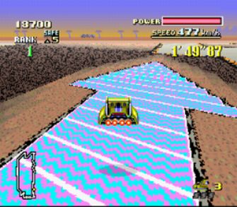
The sharrow does not give the cyclist any additional rights, as it is simply reiterating to drivers (or horse riders) that they must legally share the road with cyclists. Bryant has the added advantage of being already well utilized by cyclists coming on and off the Greenway who don’t want to die on Hennepin or Lyndale, the major thoroughfares. Whether the sharrows have anything to do with this or not is unclear, but I hear that if you ride over them when they are glowing, you get a boost of speed.
Bryant north of the Greenway becomes another simple residential road with two-way stops that baffle drivers, speed bumps that scrape their undercarriage as they speed over them, and enough width to comfortably fit two mopeds between parked cars. This brings you to the Loring Bikeway Bridge. The bridge is something of an oddment (not to be confused with a condiment). The western end is on a parking lot disguised as a street at the tip of The Wedge. Cars routinely don’t notice it while parking, though I’ve yet to see a car driving on it, which is something. This bridge has a hip-urban-looking northern side, routinely covered with sorryass-looking graffiti. It follows the I-94 onramp then takes an abrupt 180 degree turn (as few cyclists have decided to continue down I-94). This turn is fenced in by iron and is typically coated with sand, debris, and even ice.
After this perilous turn, you continue down the Loring Bikeway so named because paving a sidewalk with blacktop and putting a yellow line down the center now makes it a bikeway. Sure, there is no suggestion of where pedestrians are supposed to go on one of the most pedestrian-commuter-dense routes in Minneapolis, but we end up sharing it with little conflict. Maybe they could put pedestrian sharrows up and down it?
I then take a brief ride through Loring Park, and then join the Hennepin or First Avenue bike or bike/bus lanes, the topic of my previous entry. There is a Dominos Pizza here, which with any luck will have dancing poultry or other livestock out front. In fact, to assure this become a reality, I am emailing the city of Minneapolis soon to get a dancing livestock sharrow painted on the sidewalk. While we may not know Northeast from Southeast in Minneapolis, at least we’ll know where on Hennepin giant cocks will bust a move.
Subscribe to:
Post Comments (Atom)


No comments:
Post a Comment